10 Best Hiking Gps 2026 in the United States


Related Products
Up to 15% off


Recommended lists
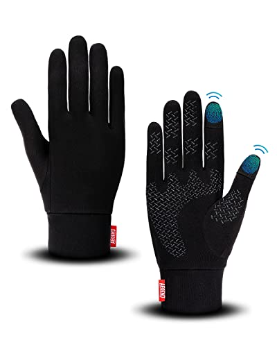
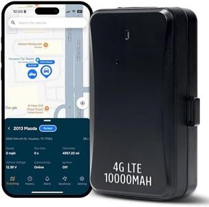
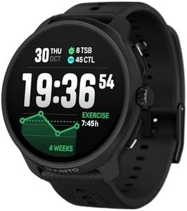
Hiking Gloves
Our technology thoroughly searches through the online shopping world, reviewing hundreds of sites. We then process and analyze this information, updating in real-time to bring you the latest top-rated products. This way, you always get the best and most current options available.
Our Top Picks
Winner
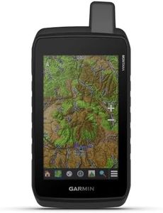
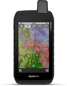
Garmin Montana® 710, Rugged GPS Handheld Navigator with Large 5-inch Glove-Friendly Touchscreen, Satellite Imagery and Maps for Routing on Roads and Trails
Most important from
48 reviews
The Garmin Montana 710 is a solid choice for hikers needing a durable and reliable GPS navigator. Its large 5-inch touchscreen is designed to be easy to use even with gloves, which is great for outdoor conditions, and the color display is clear for reading maps and satellite images. Battery life stands out with up to 24 hours of continuous GPS use and an extended expedition mode, so you won’t worry about running out of power on longer trips. It also offers flexibility by allowing you to use standard AA batteries if needed. The device is built tough, meeting military standards for shock, vibration, and water resistance, meaning it can handle rough trails and wet weather well.
The included TopoActive maps cover trails and roads, and you can add more detailed maps or satellite imagery via Wi-Fi, which is helpful for planning or finding landmarks. Navigation is boosted by built-in sensors like an altimeter, barometer, and compass, giving useful data for hiking in varied terrain. The user interface is straightforward with touchscreen controls and compatibility with the Garmin Explore app, which makes managing routes and waypoints easier.
There are some compromises, such as the Montana 710 being somewhat bulky compared to smaller handheld units, and the panel-mount option implies it’s designed to be fixed in vehicles too, which might be less convenient if you prefer a purely handheld device. Additionally, some advanced mapping content requires separate purchases or subscriptions. For those seeking a rugged, feature-rich GPS capable of handling demanding outdoor adventures and providing detailed navigation support, the Garmin Montana 710 is a well-suited option in the hiking GPS category.
Most important from
48 reviews
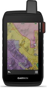
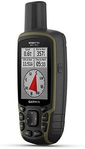
Garmin GPSMAP 67i Rugged GPS Handheld with inReach® Satellite Technology, Two-Way Messaging, Interactive SOS, Mapping
Most important from
339 reviews
The Garmin GPSMAP 67i is a highly capable handheld GPS device designed specifically for hiking and outdoor adventures. One of its standout features is its impressive battery life, offering up to 165 hours in tracking mode and 425 hours in expedition mode, which is excellent for long trips. The device's large 3-inch sunlight-readable color display ensures that you can easily view maps and data, even in bright conditions. Additionally, it supports advanced mapping and navigation features, including preloaded TopoActive maps and multi-band GNSS support, making it reliable for getting accurate location data in various terrains.
The GPSMAP 67i also comes equipped with inReach satellite technology, allowing for two-way messaging and SOS capabilities via the global Iridium satellite network, which can be a lifesaver in emergency situations when cellular coverage is unavailable. The potential to pair it with a smartphone for weather updates and geocaching adds to its versatility.
However, there are some drawbacks to consider. While the device is robust and built for outdoor use, its weight of 8.1 ounces may be a bit heavy for some users who prefer lighter options for long-distance hiking. The user interface, while straightforward, might still require some getting used to for those unfamiliar with GPS devices. Furthermore, using the inReach features necessitates an active subscription, which can add to the overall costs.
Most important from
339 reviews
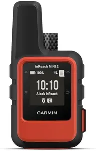
Garmin inReach Mini 2, Lightweight and Compact Satellite Communicator, Hiking Handheld, Orange - 010-02602-00
Most important from
1988 reviews
The Garmin inReach Mini 2 is a compact and lightweight satellite communicator designed for hikers who need reliable communication and navigation in remote areas. One of its standout features is its ability to provide two-way messaging and an interactive SOS function, ensuring safety during outdoor adventures, given that you have an active satellite subscription. The device is water-resistant, which is a significant plus for outdoor use, and its durability is enhanced by its rugged design.
In terms of navigation, the inReach Mini 2 offers TracBack routing, allowing users to find their way back to their starting point easily. The digital compass adds accurate heading information, which is crucial for navigation when you're off the beaten path. The integration with the Garmin Explore app enables effective trip planning and topographical mapping, making it easier to create waypoints and courses.
Battery life is impressive, boasting up to 14 days in tracking mode, making it suitable for extended hiking trips. The compact size and lightweight design (only 3.5 ounces) further enhance its portability, making it easy to carry on hikes. However, there are a few drawbacks to consider. The screen size is quite small at 1.27 inches, which may make it challenging to read in bright sunlight or for users with less than perfect eyesight. Additionally, while it has Bluetooth connectivity, the need for an active satellite subscription can be a limitation for some, adding an ongoing cost beyond the initial purchase.